****NEW WEBSITE COMING SOON****
****NEW WEBSITE COMING SOON****
CELEBRATING OVER 30 YEARS OF SUCCESSFUL OPERATIONS
QSP Geographics Inc.’s (QSP) experience working with top corporations locally, within North America and throughout the world has built an uncompromising reputation in various geospatial, field collection and CAD disciplines. We build long term partnerships with our clients by providing strategic insight through our consultative approach and deliver industry leading solutions via our investment in people, processes, equipment and technology. Our business practices are conducted with integrity, teamwork and respect for our clients and their business objectives. As a result, we have succeeded in business by adhering to our company’s core values of providing;
Quality – Our company delivers high quality final products to client specifications.
Service – We understand the importance of good communication with our clients and ensure excellent work.
Price – Our organizational and technical efficiencies result in extremely competitive pricing
OUR SERVICES AND SOLUTIONS
QSP Geographics has provided on-going operational GIS support services to a number of Canada’s largest and leading industries; including every level of the Canadian Government, Forestry, Gas, Electric, Telecommunications/Fibre and Conservation companies. In order to best serve our clients we utilze the latest software from highly recognized providers like ESRI, SmallWorld, Intergraph, Bentley Systems, SafeSoft FME, and others to accurately convert, store, and retrieve spatial data. The types of GIS Services / GIS Mapping Services we provide include;
- GIS Data Collection (Primary and Secondary capture techniques)
- Utility Mapping
- Cadastral Mapping
- Parcel Mapping
- Topographic Mapping
As the name implies, 2D CAD is used for drawing two-dimensional features which is best suited for traditional orthographic projections, such as plans, cross sections and elevations. QSP has been creating these types of 2D CAD drawings for utility companies over twenty two (22) years. In addition to the types of 2D CAD drafting services described above (Topographic and Profile Data Production) we also have experience in drafting 2D Site Plans, Construction Drawings, Resurvey Plans and Station Drawings.
In recent years, QSP expanded our drafting services to include 3D CAD as well. Through the use of a variety of different sources of information including exisiting records, assets photographs and LiDAR scan data we can create and/or update 3D intelligent models containing utility infrastructure (ie. equipment, piping, cables, etc.) with corresponding attribute information for both above and below grade assets. We are also proficient in producing isometric drawing files from the 3D models.
In addition, it was only recently when formal requirements were implemented for accurately recording the presence and location of utility infrastructure. In 2011, CSA S250 – Mapping of Underground Utilities standards were introduced because many of the map records that exist are inaccurate, obsolete or in formats incompatible between utilities. QSP understands these new requirements and respect the reasons why they are in place.
The types of Records Services that QSP provides to our clients include;
- Verification and correction of record mismatches and duplication
- Data entry
- Data updates
- Document scanning and imaging
- Database QA /QC
- Metadata creation
Over the years QSP has completed numerous GPS field data collection projects for our clients. By providing guaranteed quality through internally enforced processes, procedures and standardized deliverables it allows our clients to immediately integrate our field collected data into their GIS database. Our GPS Technicians/Technologists are all fully trained to use survey grade GPS equipment, recognize the potential impacts of environmental conditions and know how to optimize the quality of the assets or landbase features being collected, including;
- RTK status – RTK (FLOAT), DGPS, or GPS
- Satellite Geometry (PDOP, HDOP, VDOP, etc.)
- Number of satellites available
- Obstructions, line of site to satellites and any multipath influences
- Hardware damages
Depending on the project size, timeline and requirements QSP can perform field data collection exclusively or provide supplemental assistance to our client’s staff.
Since 2013 QSP Geographics has offered terrestrial laser scanning (LiDAR) services to our clients. We provide highly accurate, three-dimensional point cloud images that enables the end user to view, navigate, measure and analyze the 3D data using GIS and/or CAD software. To date, our LiDAR services have been used for Infrastructure and Utilities projects.
INDUSTRIES SERVED
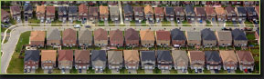
Land Management
For over 25 years QSP has been a significant supplier of parcel fabric, cadastre and base mapping products. These datasets provide governments and utilities the foundation needed to support spatial applications such as land registration, property assessment & taxation, land use planning, land management and business planning.

Oil and Gas
For over 21 years QSP has been servicing the Natural Gas Distribution, Transmission and Pipeline market segments for some of the largest utilities in Canada. As a volatile commodity, access to accurate records and precise geospatial locations are critical requirements for these industries.

Electric
Since deregulation, Local Distribution Companies (LDC) have faced increasing challenges meeting the demands of their customers while complying with ever increasing government regulations. QSP has the tools and experience to ensure LDC’s meet and exceed these requirements.

Telecom
With the ever increasing demand for high speed internet and reliable communications the Telecommunications industry must be able to react quickly to new and emerging technologies. QSP can provide the GIS and CAD experience needed for marketing, network planning, engineering and construction, sales and customer care.
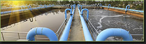
Water and Wastewater
In order to maintain health and economic prosperity, a municipality’s water and wastewater systems are vital components to its community. This includes the operation and maintenance of facilities such as sewer lines, water distribution systems, water pumping stations and valves. QSP has the GIS and CAD solutions to assist any municipality with efficient planning, design, inventory and management of this essential infrastructure.
Natural Resources
Land is the fundamental resource for almost all human uses. Therefore it is easy to understand why resource inventory and management was one of the earliest uses of GIS. Natural resource managers rely heavily on accurate data in order to make critical decisions while using GIS to manage the earth’s resources. QSP has supported this industry with GIS, CAD and Records services for natural resource segments such as Agriculture, Forestry, Geology, Watershed and Water Resources.